Since this page is automatically translated by the machine, it may be less accurate than human being's work.
Ministry of Land, Infrastructure and Transport_National bus stop location information
This is file data of bus stop location information collected on a specific date from local governments that have established a local bus information system (BIS) and are linked to the National Public Transport Information Center (TAGO). It provides stop number, stop name, latitude, longitude, information collection date, local government, and managing local government. This information is not directly created data, but is integrated and provided through standardization of formats, etc. by linking information from each local government BIS. It provides information on the date the information was collected (once a year), and does not reflect any changes thereafter.
The Public Data Utilization Support Center automatically converts and provides open-format file data of three or more steps open to public data portals into open APIs (RestAPI-based JSON/XML).
To use the open API, you need to sign up for a public data portal membership and apply for utilization. For inquiries about utilization, please contact the Public Data Utilization Support Center.
File data can be used by downloading without logging in.
To use the open API, you need to sign up for a public data portal membership and apply for utilization. For inquiries about utilization, please contact the Public Data Utilization Support Center.
File data can be used by downloading without logging in.
Ministry of Land, Infrastructure and Transport_National bus stop location information
File data information Download metadata Provides schema.org based metadata.
The Public Data Utilization Support Center automatically converts and provides open-format file data of three or more steps open to public data portals into open APIs (RestAPI-based JSON/XML).
To use the open API, you need to sign up for a public data portal membership and apply for utilization. For inquiries about utilization, please contact the Public Data Utilization Support Center.
File data can be used by downloading without logging in.
To use the open API, you need to sign up for a public data portal membership and apply for utilization. For inquiries about utilization, please contact the Public Data Utilization Support Center.
File data can be used by downloading without logging in.
Ministry of Land, Infrastructure and Transport_National bus stop location information
Open API Information Download metadata Provides schema.org based metadata.
| Service | Ministry of Land, Infrastructure and Transport_National Bus Stop Location Information_20251031 | ||
|---|---|---|---|
| Classification System | Transportation and logistics - road | Provider | |
| Management Agency | Public Data Utilization Support Center | Management agency phone number | 1566-0025 |
| Basis For Retention | Article 90 (4) of the National Integrated Transportation System Efficiency Act | Collection Method | |
| Update Cycle | yearly | Next Enrollment Date | 2026-10-30 |
| Media Type | Text | Whole Row | 206022 |
| Extension | XML, JSON | Application For Use | 284 |
| Data Limit | Keyword | bus stop,Location information,Bus Information System,Bus stop locations nationwide,Station latitude and longitude,Bus stop name | |
| Enrollment | 2025-11-09 | Correction | 2025-12-09 |
| Form Of Provision | Download from open data Portal (the original text file registration) | ||
| Explanation | This is file data of bus stop location information collected on a specific date from local governments that have established a local bus information system (BIS) and are linked to the National Public Transport Information Center (TAGO). It provides stop number, stop name, latitude, longitude, information collection date, local government, and managing local government. This information is not directly created data, but is integrated and provided through standardization of formats, etc. by linking information from each local government BIS. It provides information on the date the information was collected (once a year), and does not reflect any changes thereafter. | ||
| Other Notes | Mobile speed dial blank - uncollected data | ||
| Payment | free | Charge Standard And Unit | Case |
| Scope Of Use | The use permission range limitless | ||
Usage Specification
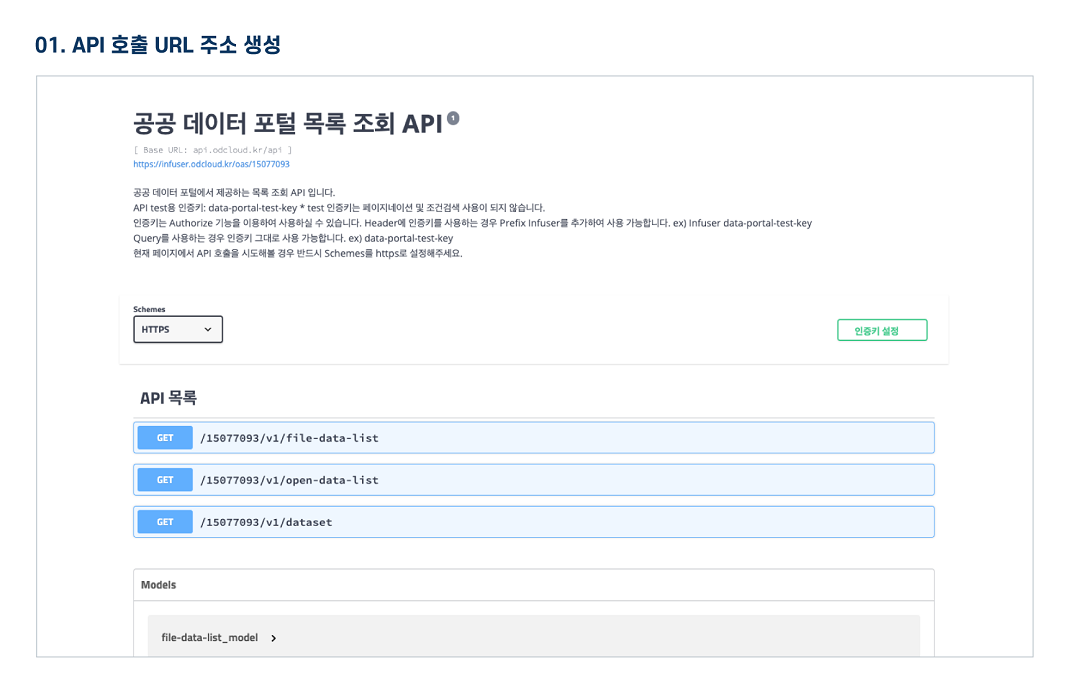
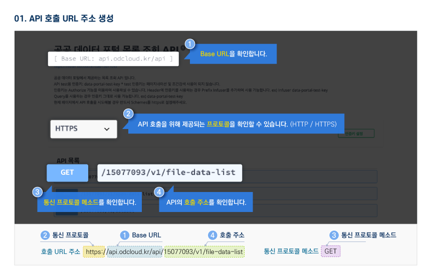
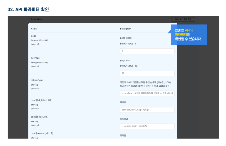
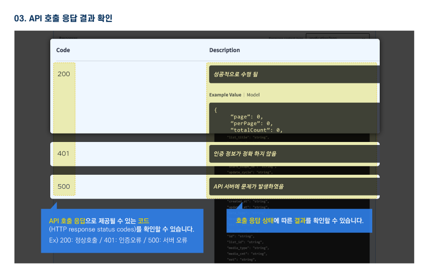
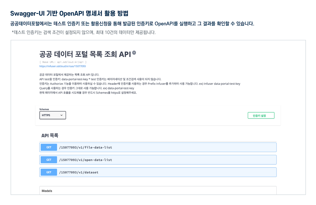
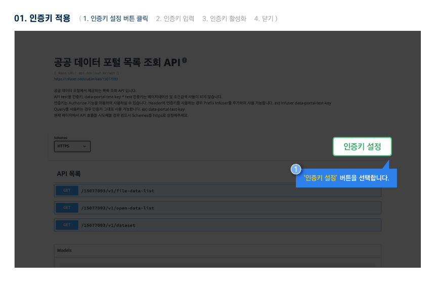
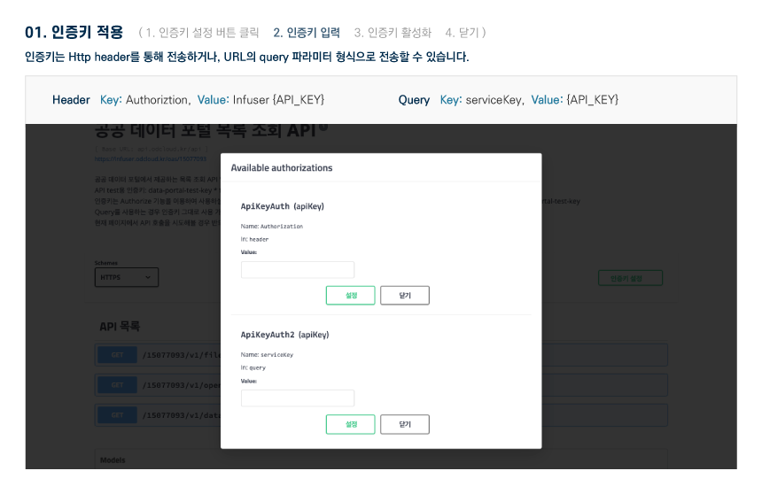
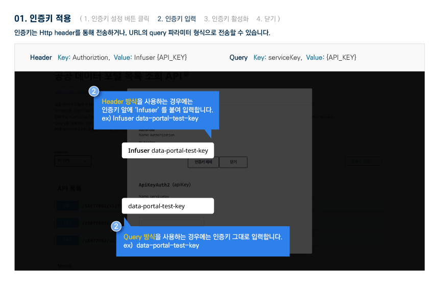
Open API 명세 확인 가이드
