Since this page is automatically translated by the machine, it may be less accurate than human being's work.
Chungcheongbuk-do Chungju_Forest fire spread risk area
This data provides information on forest fire spread risk areas in Chungju, North Chungcheong Province, developed through the 2022 Public Data Enterprise Matching Support Project. It was created to proactively identify areas at high risk of forest fire spread and to facilitate disaster response strategies and prevention initiatives. It includes risk assessment results for each region. The data consists of administrative numbers, townships, and districts, road addresses, latitude and longitude coordinates, forest fire spread scores (risk), and ratings. These ratings are based on the scores and indicate relative risk levels. Risk scores are calculated by considering factors that influence forest fire spread, such as wind speed, topography, vegetation, and nearby access roads. These ratings are typically categorized as 1 to 5 or high/low risk. This data can be utilized for various disaster management purposes, such as prioritizing forest fire prevention by region, prioritizing disaster management budget allocation, securing firefighting response bases, and providing guidance to residents in forest-adjacent areas. Latitude and longitude information can be utilized for GIS-based spatial information analysis and visualization, and is also useful as a reference for developing real-time risk prediction models and planning forestry policies.
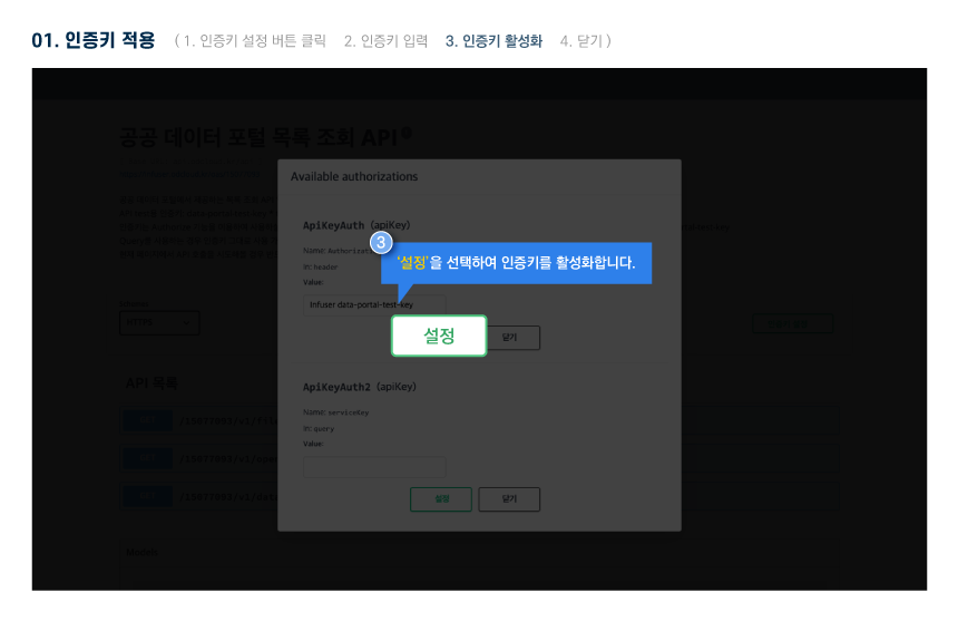
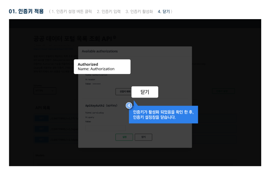
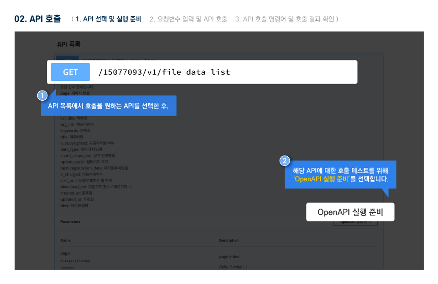
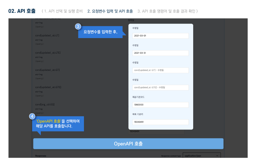
※ Application for use is only available on the PC version.
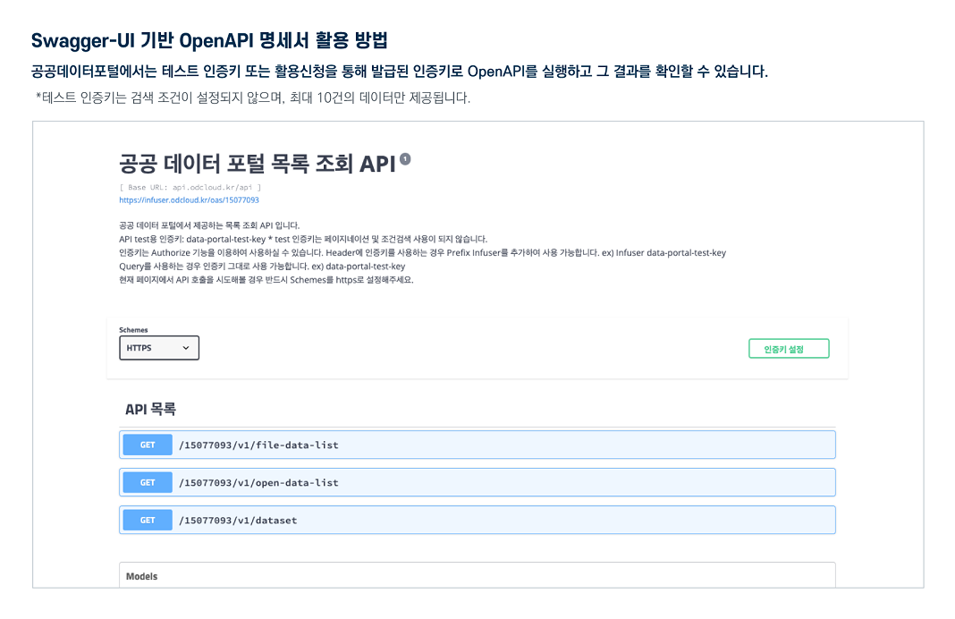
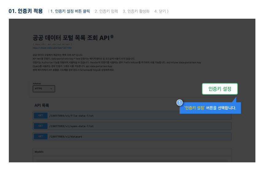
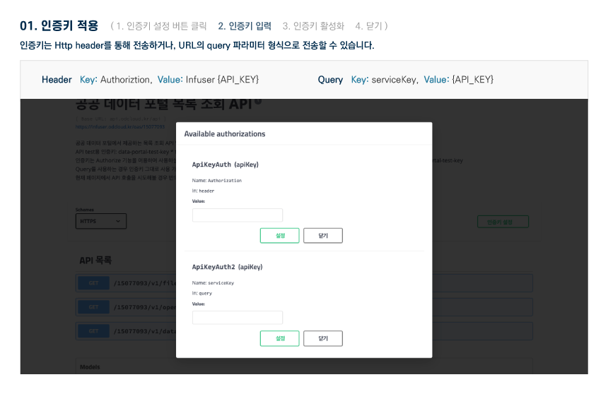
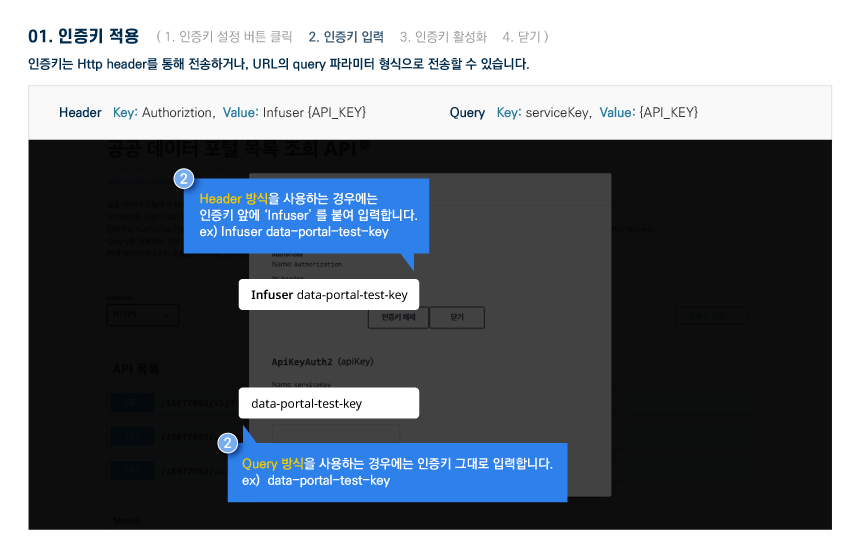
About OpenAPI
Download metadata
Provides schema.org based metadata.
About OpenAPI
Download metadata
Provides schema.org based metadata.
Function
- Application for Use Development level : allowed / Operation level : Not allowed
- Available traffic 100000 / Operational account can increase traffic by applying for use case registration
- Requested Link http://apis.data.go.kr/4390000/forestFireSpreadRisk/getforestFireSpreadRisk
- Service URL http://apis.data.go.kr/4390000/forestFireSpreadRisk
Request Parameter
Request Parameter
| Category(Korean) | Category(English) | Size | Division | Sample Data | Description |
|---|---|---|---|---|---|
| serviceKey | Essential | - | Authentication key received from public data portal | ||
| type | Essential | xml | Data type (json: json type data output xml: xml type data output) Basic: XML |
Response Element
Response Element
| Category(Korean) | Category(English) | Size | Division | Sample Data | Description |
|---|---|---|---|---|---|
| header | Essential | header | |||
| body | Essential | body |
Sample Code
Please check the sample code on your PC.